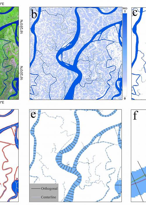
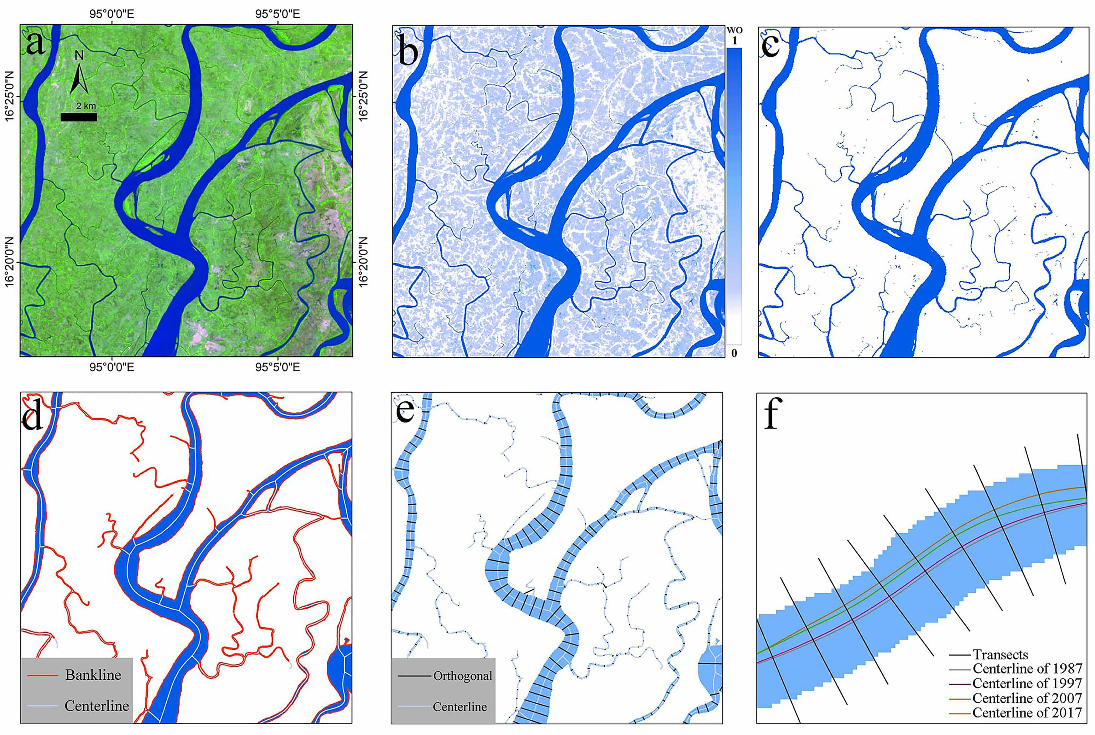
基于Landsat时间序列的三角洲河道网络量化研究
河道网络是河流三角洲的主干,是陆海之间水、沉积物、有机物等物质与能量交换的重要通道。三角洲河网结构及其河道宽度、深度、长度和弯曲度的空间变化对水文动力和输沙过程有着显著影响。径流和输沙量、河岸植被、海平面上升、波浪和潮汐的变化可迫使河道发生横向迁移以及宽度改变。目前,为了更好地保护人口密集且地势低洼的沿海地区不受洪水侵袭,世界上越来越多的三角洲河道已经被堤坝、堤防和水闸等所固定,河流的原始流动状态被改变。例如,沿着密西西比河水系已经修建了4600多公里的堤坝和防洪堤,这影响了河流搬运沉积物以及支撑重要生态系统服务的能力。
中国海岸带盐沼植被时序雷达遥感分类研究
盐沼植被是滨海湿地最具生产力的生态系统之一,具有提供野生动物栖息地、消浪护岸、水源涵养、水质净化等生态功能。尽管海岸带盐沼植被生态系统具有丰富的生态功能和应用价值,但在全球变暖、海平面上升、人类围垦活动加剧、生物入侵、陆源污染输入等背景下,盐沼植被系统面临着巨大威胁,正以前所未有的趋势减少。目前全球湿地丧失面积已达50%以上,而在中国,由于人类围垦活动,在过去的40年间,盐沼植被的减少了59%。
About
The estuary and coastal scientific data sharing service sub-center is based on the marine scientific data collection standard specification of the main center, establishes a complete sub-center estuary and coastal data collection and update mechanism, and builds a sub-center marine scientific data subordinate to the national marine scientific data sharing service platform The sharing system provides comprehensive and authoritative marine data services for national marine workers and the public.